Rainbow Falls Trail
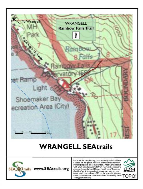
Rainbow Falls Trail offers a short day trip to a waterfall, or long day or overnight hikes into the high country above Wrangell. The Rainbow Falls Trail is a short, steep hike to see Rainbow Creek in a lush hemlock forest. If you’re interested in a longer hike, the trail continues beyond the falls as the Institute Creek Trail, which leads to a trail shelter at an overlook of Shoemaker Bay. A branch of the trail climbs into higher country as the North Wrangell Trail, leading to the High Country and Pond Shelters. The trails are almost entirely surfaced with stairs, log steps, and “step and run” boardwalk. If this is your first boardwalk hike, keep in mind that all the can be tough on people with knee or hip injuries.
Special features: Rainbow Falls, montane forest and wet meadows, ridgetop views, 2 trail shelters.
Length: 0.8 miles one way to the waterfall
Elevation: 500 feet elevation gain to waterfall
Difficulty: Boardwalk can be slippery, steep sections, some steps
Starting Point: Trailhead is at 4.5 mile Zimovia Highway (approximately 4.5 miles from downtown area, add 1/2 mile if coming from airport of ferry terminal). You can walk, bike or take a cab to the trailhead.